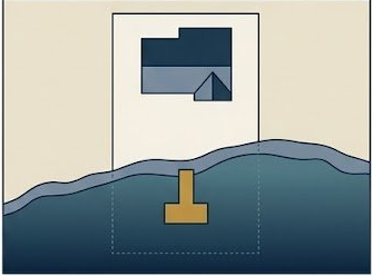
A missing or inadequate site plan is the single most common reason dock permit applications are declared incomplete and returned to the applicant. Every major dock permitting agency — TVA, Florida DEP, Michigan EGLE, Georgia CRD, and the Army Corps — requires a site plan as part of the application. The good news: for most residential dock projects, you do not need to hire a licensed surveyor to create an acceptable site plan. You need to know what the plan must show.
What Every Site Plan Must Include
Across all major agencies, a dock permit site plan must show the following core elements:
Location and Orientation Elements
- North arrow — a simple N-arrow in the corner is sufficient; don't omit this
- Scale — either a bar scale or a stated ratio (e.g., "1 inch = 20 feet"); the plan must be drawn to scale
- Property boundaries — all four property lines with dimensions
- Ordinary high water line (or mean high water line for tidal areas) — this is the legal shoreline boundary
- Existing structures — house, outbuildings, existing docks or boat ramps, seawalls
Dock Location and Dimensions
- Proposed dock footprint drawn to scale — the exact shape of the dock from above
- Total dimensions — overall length and width, platform dimensions, walkway dimensions
- Setback from property lines extended into water — most agencies require minimum setbacks from neighboring property lines; measure and label these
- Distance from shore — how far the dock extends from the ordinary high water line
- Water depths — depth at the end of the dock (and sometimes at intervals); TVA and DEP both commonly require this
Context Elements
- Neighboring docks and structures — show any existing docks on adjacent properties within 100 feet
- Navigation channels or waterway markers — if any exist near your property
- Vegetation zones — location of any aquatic vegetation beds, especially seagrasses (required by Florida DEP)
- Access corridor to water (TVA-specific) — TVA requires the access corridor from your property line to the water to be shown
Views Required: Top View and Side View
Most agencies require both a top-down (plan) view and at least one cross-section (profile) view:
The top view shows the dock's footprint, dimensions, orientation relative to the shoreline, and relationship to property lines. This is what most people think of as "the site plan."
The cross-section view shows the dock from the side: the piling heights above water, deck height above water, water depth at various points, and clearance from the water surface. TVA and Army Corps applications almost always require this. It helps reviewers assess navigation clearance and structural compliance.
Do I Need a Licensed Surveyor?
For most standard residential dock projects, a professional survey is not required — but your plan must be accurate and drawn to scale. Acceptable approaches include:
- Hand-drawn plans: Accepted by TVA, Michigan EGLE, and most state agencies for straightforward residential projects. Must be legible, accurate, and to scale. Use graph paper for ease.
- CAD or drawing software: Google Drawings, SketchUp, or similar free tools can produce clean, scaled plans without professional software.
- Aerial imagery base: Print a Google Maps or county GIS aerial of your property and trace/annotate over it. Many agencies accept this, especially when combined with field measurements.
- Professional surveyor required: Some projects do require a licensed survey — particularly those on Great Lakes shoreline (Michigan Part 325), tidal coastal areas with complex boundaries, or any project where the precise location of the ordinary high water line is disputed.
Common Site Plan Rejection Reasons
Based on publicly available agency guidance and common application deficiencies, the most frequent reasons site plans are returned as inadequate:
- No north arrow — simple omission, but flagged every time
- Not drawn to scale — the plan says "approximate" without a scale bar; agencies won't accept this
- Missing water depths — particularly flagged by TVA and Florida DEP
- Missing setback measurements — the distance from property lines is not labeled
- Neighboring structures not shown — agencies need context to evaluate navigation and property impacts
- Seagrass or vegetation not addressed — Florida DEP applications in coastal areas must address aquatic vegetation
- Cross-section view missing — the top view alone is often insufficient
- Access corridor not shown (TVA) — TVA specifically requires the access corridor from the property line to the water
Photographs: Required Alongside the Site Plan
All major agencies require photographs submitted with the application. Required photos typically include:
- Shoreline from the water, looking left
- Shoreline from the water, looking right
- View from shore looking straight out over the proposed dock location
- View from the water looking at the property
- Any existing dock or structures on the property
- The proposed construction area showing current vegetation conditions
Label each photograph with the direction it was taken and what it shows. Unlabeled photos are frequently flagged as inadequate.
Free Download: Dock Permit Application Prep Checklist
Includes a complete site plan component checklist and photograph requirements — everything to confirm before submitting your application.
Download Free PDF →